Kane County is committed to understanding how available water supply can meet future demand and to safeguarding the long-term integrity of the county’s water resources.
Kane County faces several water supply challenges:
- Shallow groundwater aquifers are susceptible to contamination
- Deep groundwater aquifers are undergoing a decline in water levels.
- Withdrawals from the Fox River are regulated to maintain minimum instream flows and limit nutrient loading.
Community water supply
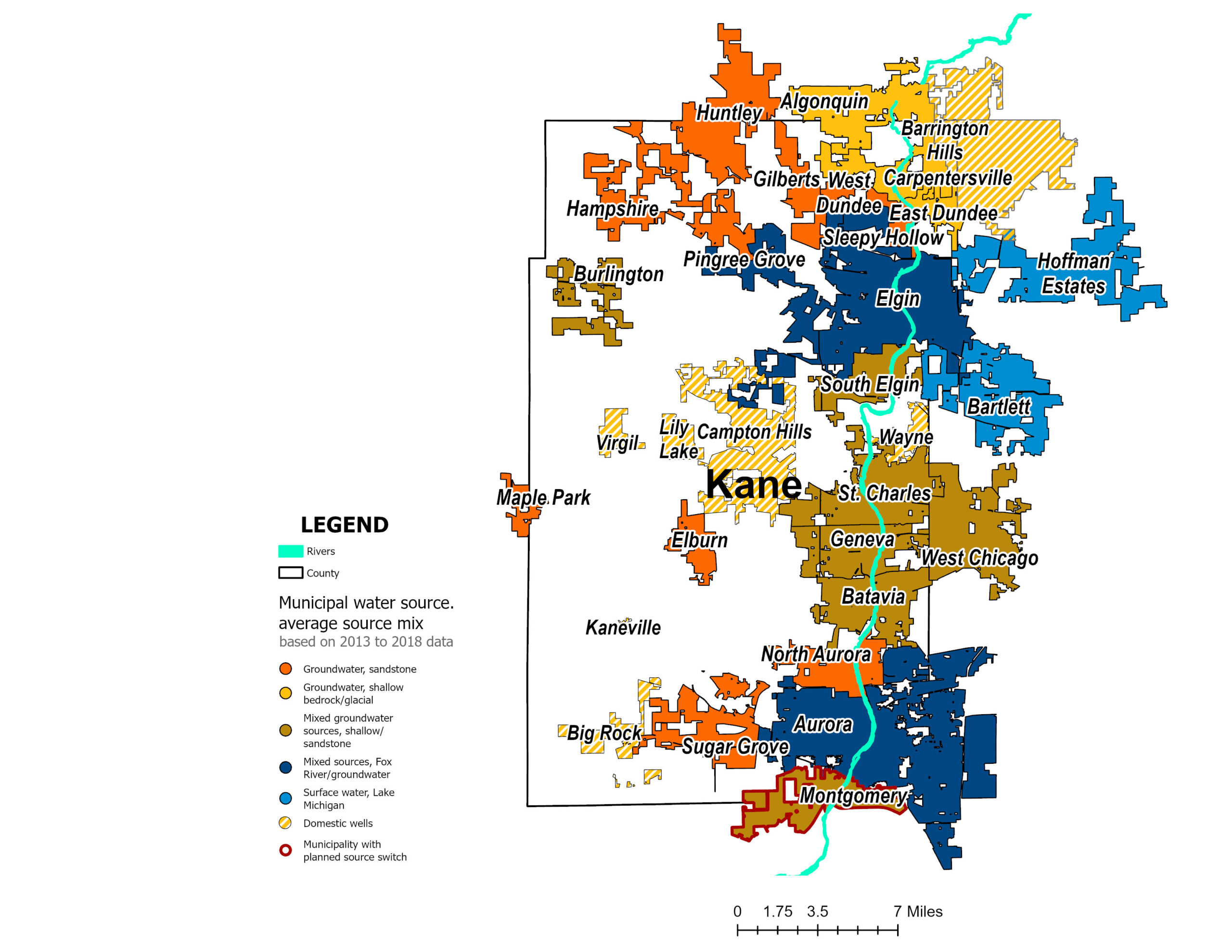
Kane County’s water supply comes from groundwater aquifers and the Fox River. This map shows the community water-supply sources across the county, while residents and businesses outside incorporated areas rely on private wells.
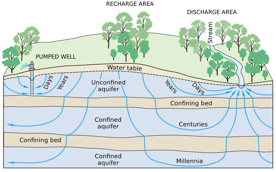
Beneath the surface: Kane’s aquifers
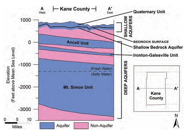
Kane County’s groundwater includes both shallow aquifers and deeper sandstone aquifers. Groundwater originates from rain that soaks through the land into underground aquifers. Because this process takes time, the rate at which we take water from aquifers can exceed the rate at which rain recharges the aquifer. Over time, the groundwater levels in the county have declined due to increased water withdrawal rates from the aquifers.
The Fox River
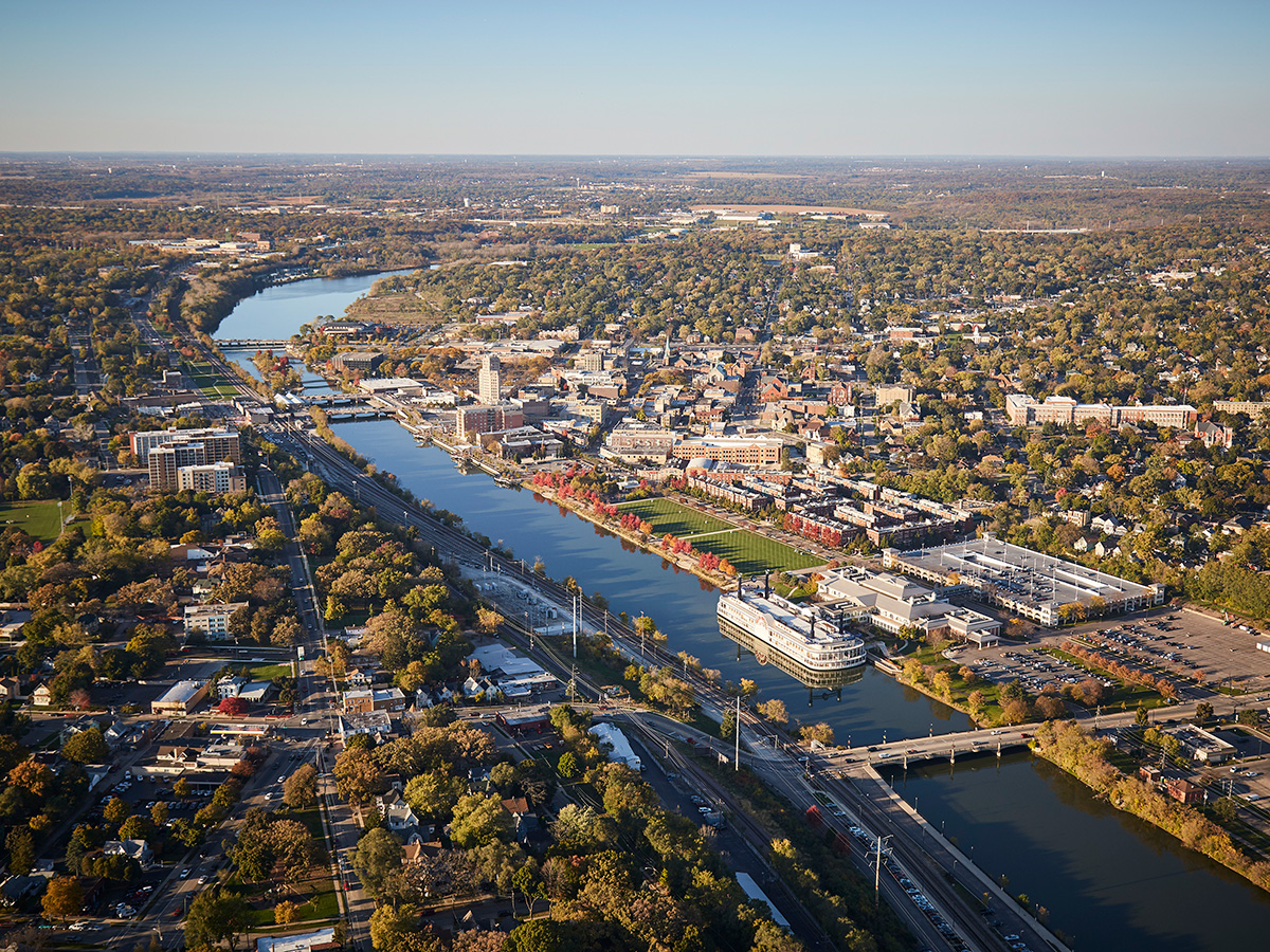
Photo Credit: Chicago Metropolitan Agency for Planning (CMAP)
The Fox River ecosystem provides a water supply, recreational opportunities, and wildlife habitat. As the Fox River watershed has continued to be urbanized, both wastewater discharges into the river as well as water withdrawals from the river have increased. While groundwater provides the majority of the county’s water supply, the Fox River plays an important role.
Dive deeper
Kane County has supported scientific investigations by the Illinois State Water Survey (ISWS) and Illinois State Geological Survey (ISGS) to advance water-supply planning.
Groundwater-quality samples are collected from a countywide network of observation wells, and the data support long-term water-supply planning.
Visit the Kane County Groundwater Monitoring Network website
The Illinois State Water Survey (ISWS) and the Illinois State Geological Survey (ISGS) have conducted numerous studies in Kane County, including large-scale measurements of shallow water levels, mapping of aquifers, and development of regional and local scale groundwater flow models.